
Getting here
This Local Nature Reserve consists of mixed woodland and grassland with wonderful views across the Weald and Greensand ridge towards the South Downs
By Road
- West Hanger Car Park: Staple Lane, East Clandon, GU5 9TD
- Free car park
- This car park has unmarked car parking spaces
- If visiting with tall vehicles, please be aware our car parks have a height barrier. Max Height 1.9m – 6’2”
By Public Transport:
- Nearest Train Station is Gomshall
- There are no public buses to Shere Woodlands
- Surrey Connect Bus Service to West Hanger car park
Surrey Connect is the ideal way to access Surrey’s countryside. This convenient on-demand bus service is available to all, making Surrey’s countryside more accessible for those without access to a car or who want to choose a more sustainable option.
Book your journey via the Surrey Connect app, website or by phone. Select Central North as the territory, and Shere Woodlands as your bus stop.
By Bicycle:
- Cyclists are permitted on this site, but must only use bridleways or byways that run through the site
- There is access from this site onto the North Downs Way National Trail, a 153 mile multi-user route between Surrey and Kent. For further information, please visit the National Trails website
- For directions, please use the map below
- For details on bridleway, byway or footpath information please visit our Countryside interactive map
By Foot
- For directions, please use the map below
- For details on bridleway, byway or footpath information please visit our Countryside interactive map
Horse Riding
- Horse riders are permitted, but must use the bridleways. Where possible horse riders should keep to wider paths. Please refer to the interpretation board on site for further information
- There is no horsebox parking available at this countryside site
- For details on bridleway, byway or footpath information please visit our Countryside interactive map
Location map
On the map below, use the plus symbol to zoom in to see the locations of the site's paths and car parks and the minus symbol to zoom out to view where the site is situated in Surrey, and to see other countryside sites nearby. The home symbol resets the map to the default setting.
Things to see and do
Shere Woodlands, including West Hanger, Combe Bottom and the Netley Plantation, are on the scarp slope of the North Downs. The area was of great strategic importance during World War II as the North Downs was used as an important line of defence.
Key points of interest:
- Two self-guided trails; Yew and Butterfly trails
- Seasonal highlights; Autumn colour, summer wildflower, spring bluebells
- Viewpoints
- North Downs Way which is popular with cyclists exploring the Surrey Hills
- The area was billeted with thousands of Canadian troops and the woodlands adjacent to Francis Corner contain many concrete roads, water tanks and the brick footings of military buildings which were used by the Canadian forces
- Many pillboxes also remain in various states of repair
- This area once formed part of the Bray Estate of Shere who used it to produce timber for their use and for Gomshall Tannery
- The woodlands suffered badly in the 1987 storms, when many 250-year-old beech trees fell. Today we see the benefit to biodiversity in the fallen trunks
Nature to discover:
- Trees: Beech, yew, cedar, juniper, conifer
- Flora and fauna: Marjoram, wild basil, dog rose
- Birds and butterflies: Red Kites, great spotted woodpecker, gold finch, gold crest and Red admiral, green hairstreak butterflies
Always respect, protect and enjoy leaving no trace of your visit.
Facilities
- Benches are located throughout this site
- Dogs allowed. Please keep dogs under close control and on paths
- There are no bins on this site, please take your litter and dog waste home with you
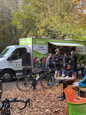
- Refreshments can be found on site at West Hanger car park with our mobile caterer, Allez Nutrition. Open weekends only
- There are no toilets on site. The closest toilets are located at Newlands Corner and the village of Shere
Self-guided trails
There are two self-guided trails at Shere Woodlands, the Yew and Butterfly trails. Take a photo of the information board in the car park before setting off and follow the colour coded routes and signposts along the way.
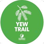 The Yew self-guided trail – 3.5 mile, 1 hour 40 minute walk
Follow the Yew circular trail from West Hanger car park and explore the peaceful woodland, forest tracks and stunning views of Shere Woodlands. Some steep slopes and uneven ground in parts. You can do a shorter version of this route (2.7 Miles) by following the North Downs Way back to West Hanger Car Park.
Follow the Yew route on the digital Ordnance Survey (OS) map.
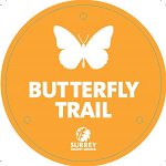 The Butterfly self-guided trail – 1 mile, 30 minute walk
Follow the short circular Butterfly trail, which mostly takes you along the North Downs Way National Trail with a bench and stunning viewpoint halfway.
Follow the Butterfly route on the digital Ordnance Survey (OS) map.
Additional information:
The North Downs Way, a National Trail starting in Farnham, Surrey and finishing 153 miles later in Dover, Kent runs right through Shere Woodlands.
For more walking trail inspiration, please visit our Self-guided walks around Surrey webpage.
Accessibility
- There are no accessible self-guided trails at this site
- The woodland path can be steep and uneven in places
- This car park has unmarked car parking spaces
- Refreshments can be found on site at West Hanger car park with our mobile caterer, Allez Nutrition. Open weekends only
- There are no toilets on site. The closest toilets are located at Newlands Corner and the village of Shere
- The nearest accessible trail is located at Francis Corner
Contact Us
This site is owned by Surrey County Council.
To contact us, please use one of the options below:
Email: countryside.estate@surreycc.gov.uk
Phone: 03456 009 009
Send us any photos you take that you're happy to share on social media, tag @ExploreSurreyUK
Newsletter
Did you know the Countryside team have a newsletter? Countryside Matters is a seasonal newsletter that will keep you up to date on what's going on across Surrey's countryside, including what our countryside teams are working on.
Sign up to our countryside newsletter