
Getting Here
This Local Nature Reserve was bought by Surrey County Council in 1936, safeguarding 270 acres of public open access space for the future. A mixture of woodland and grassland with wonderful wildflower displays and panoramic views of the London skyline from the Millennium viewpoint.
By Road
- St Mary’s Church Car Park: West Horsley, Leatherhead KT24 6AP
- Shere Road Car Park: West Horsley, Leatherhead KT24 6EP
- Green Dene Car Park: Green Dene, East Horsley, Leatherhead KT24 5TA
- All car parks are free
- These car parks have unmarked car parking spaces
- If visiting with tall vehicles, please be aware our car parks have a height barrier. Max Height 1.9m – 6’2”
By Public Transport
- Nearest Train Station is Horsley
- Bus Provider and bus stop: Falcon Bus Service 479, Duke of Wellington
- Surrey Connect Bus Service to St Mary’s Church, Shere Road and Green Dene car parks
Surrey Connect is the ideal way to access Surrey’s countryside. This convenient on-demand bus service is available to all, making Surrey’s countryside more accessible for those without access to a car or who want to choose a more sustainable option.
Book your journey via the Surrey Connect app, website or by phone. Select Central North as the territory, and either St Mary’s Church, Shere Road or Green Dene car park as your bus stop.
By Bicycle
- Cyclists are permitted on this site, but must only use bridleways that run through the site
- For directions, please use the map below
- For details on bridleway, byway or footpath information please visit our Countryside interactive map
By Foot
- For directions, please use the map below
- For details on bridleway, byway or footpath information please visit our Countryside interactive map
Horse Riding
- Horse riders are permitted, but must use the bridleways. Where possible horse riders should keep to wider paths. Please refer to the interpretation board on site for further information
- There is no horsebox parking available at this countryside site
- For details on bridleway, byway or footpath information please visit our Countryside interactive map
Location map
On the map below, use the plus symbol to zoom in to see the locations of the site's paths and car parks and the minus symbol to zoom out to view where the site is situated in Surrey, and to see other countryside sites nearby. The home symbol resets the map to the default setting.
Visitor Information Video
Things to see and do
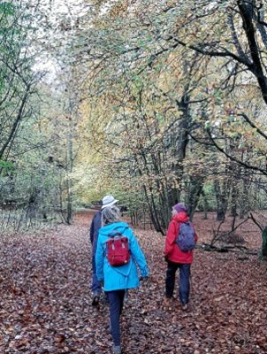
As the name suggests, Sheepleas was used for grazing for hundreds of years. Today, with the sheep long gone, Sheepleas is a patchwork of ancient and new woodland, grassland and scrub which supports a wide range of wildlife.
Key points of interest
- Two self-guided trails; Hazel and Orchid trails
- Seasonal highlights; spring bluebells, summer wildflower meadows, autumn colour
- Ancient woodland
- Millennium viewpoint
- One of the original 284 Rothschild Reserves, the site was once described as ‘the finest piece of botanical and entomological ground within 30 miles of London’
- Sheepleas is home to more than 30 species of butterfly
- Look out for rare orchids, a staggering 12 species have been recorded
- Ornate ‘Lovelace’ bridges constructed in 1860 to transport timber around the East Horsley Estate
Nature to discover
- Trees: Hazel, oak, beech
- Flora and fauna: Greater butterfly-orchid, pyramidal orchid, common-spotted orchid, cowslip, common dog-violet, primrose, bluebell, wild marjoram, harebell, common knapweed, autumn gentian
- Butterflies: Brown argus, silver-washed fritillary, purple emperor
- Mammals: Hazel dormouse, bats, roe deer
Always respect, protect and enjoy leaving no trace of your visit.
Facilities
- Picnic Area
- Benches located throughout this site
- Dogs allowed. Please keep dogs under close control and on paths
- There are no bins on this site, please take your litter and dog waste home with you
- There are no refreshments or toilets on site. The nearest café is at the Tiger Lily Bus Company based in the courtyard at West Horsley Place. The closest toilets are located at The Duke of Wellington Pub or East Horsley Squires Garden Centre
Self-guided trails
There are two trails with signposts at Sheepleas, they are the Orchid and Hazel self-guided trails. Follow the colour coded routes on the information boards in each car park and the coloured waymarks along the way. There are no kissing gates or stiles en route but please note that paths can be slippery on the chalk surfaces.
 The Orchid self-guided trail - 2 miles, 1 hour walk
Follow the Orchid waymarks from either Shere Road or St Mary's car parks. It is a gentle uphill climb from St Mary's car park, but easy walking with some gentle slopes past the picnic area, Millenium Viewpoint, through wildflower meadows and areas of woodland.
Follow the Orchid route on the digital Ordnance Survey (OS) map.
 The Hazel self-guided trail - 2 miles, 1 hour walk
This circular trail starts from Green Dene car park and provides easy walking with some slopes and narrow tracks. There are many magnificent trees along the way, remnants from the days when Sheepleas was part of the Lovelace Estate.
Follow the Hazel route on the digital Ordnance Survey (OS) map.
Additional Information:
The Horlsey Woodland Trail, a 7.5 mile circular walk with many historic points of interest goes through this site.
For more walking trail inspiration, please visit our Self-guided walks around Surrey webpage.
Accessibility
- There are no accessible self-guided trails at this site
- The paths can be steep and uneven in places
- The car parks have unmarked car parking spaces
- There are no refreshments or toilets on site. The nearest café is at the Tiger Lily Bus Company based in the courtyard at West Horsley Place. The closest toilets are located at The Duke of Wellington Pub or East Horsley Squires Garden Centre
- The nearest accessible trail is located at Francis Corner
Contact Us
![]()
This site is owned by Surrey County Council with conservation managed by Surrey Wildlife Trust.
To contact us, please use one of the options below:
Email: countryside.estate@surreycc.gov.uk
Phone: 03456 009 009
Send us any photos you take that you're happy to share on social media, tag @ExploreSurreyUK
Newsletter
Did you know the Countryside team have a newsletter? Countryside Matters is a seasonal newsletter that will keep you up to date on what's going on across Surrey's countryside, including what our countryside teams are working on.
Sign up to our countryside newsletter