Page Contents
About the walk
- Start address: Old Town Hall 15 High St, Haslemere, GU27 2HG
- Distance: 3.5 miles
- Approximate time: 1.5 hours
- Grid reference: Haslemere SU905328, at end of section Gibbet Hill SU899360
- Use OS Explorer map: 133
Walk directions
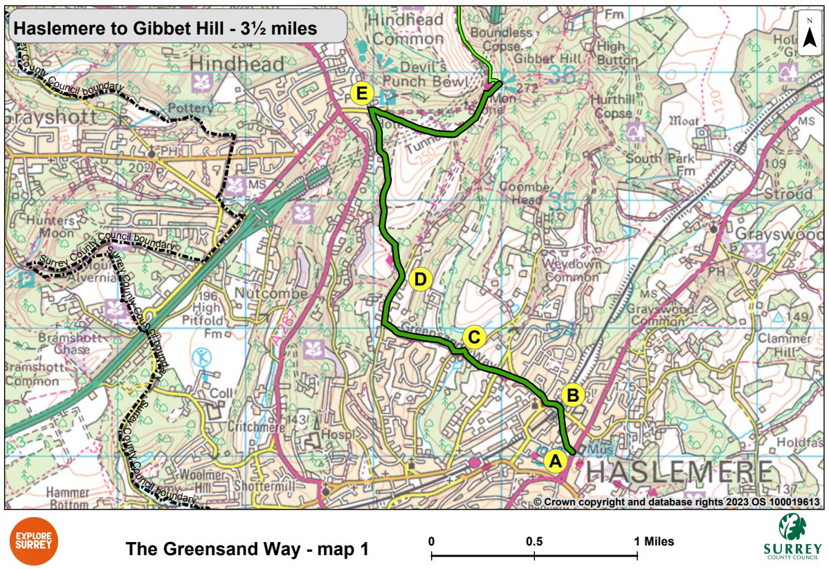
The following letters correspond with the route directions on the map.
A. From the Old Town Hall in Haslemere, walk along the left side of the High Street (A286 to Guildford). Soon after The Georgian Hotel, turn left between buildings and follow the footpath to Church Lane. A Greensand Way green metal sign can be found on the brickwork.
B. Cross the road and turn left over the railway bridge. Turn right at the triangle below St Bartholomew's Church then continue up High Lane for 250 yards. At the house named Ventnor, cross to the left side of the road, then turn right up a narrow path between fences. Cross the road and take the field path downhill.
C. Turn left along Bunch Lane for 100 yards, then turn right, up Stoatley Hollow. Keep left beside farm buildings and continue uphill. Turn right, beside the house named Puckfold onto a rough semi-metalled track. Turn right at the T-junction and continue for 380 yards.
D. Turn left opposite house named Little Scotstoun. Follow the path through woodland and over heath, then go steeply downhill for 650 yards, ignoring all side tracks. Cross a broad track in the valley bottom, keep ahead uphill. At the top, continue ahead, skirting gardens. At a junction of tracks, take the central track ahead. Continue almost to the road (old A3 at NT Devils Punchbowl).
E. Turn back through 45 degrees. Follow a broad sandy track across Hindhead Common for 710 yards. At a seat beneath trees, leave the main track to walk left uphill. Cross an open space where five ways meet. Walk ahead over Gibbet Hill, leaving the triangulation point on your right and the Celtic Cross on Gibbet Hill to your left. Note: National Trust Hindhead café and facilities are nearby.
What to see
Haslemere Old Town Hall was originally built in the 17th century and rebuilt in a similar style in 1814. It used to have arcades with the ground floor open.
St Bartholomew's Church tower dates from the 13th century. The rest of the church was rebuilt in the late 19th century. A window by Burne-Jones commemorates the poet Tennyson who lived on Blackdown one mile away.
The Celtic Cross on Gibbet Hill made of Cornish granite, marks the place where three robbers were hanged on 24 September 1776, for the murder of an unknown sailor on the London to Portsmouth road.
Map 1
The first section of the Greensand Way shows the route from Haslemere Old Town Hall to the signposted start to Church Lane, past St Bartholomew's Church, through Stoatley Hollow and Hindhead Common Devil's Punchbowl to Gibbet Hill. Select the map of the route below to open a larger version in a new window, that can be printed, if necessary, using your browser print tool with landscape selected. Alternatively, you can save the image to your mobile device, for reference on your walk.