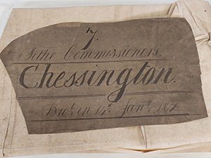
 At Surrey History Centre we hold original tithe maps and apportionments for the old county of Surrey, including for those parts which are now London boroughs. Tithe maps were produced as a result of the 1836 Tithe Commutation Act. You can find out more about them in our research guide.
A large tithe map of Chessington (reference 864/1/27) was selected for conservation as it had become very fragile due to damp damage in previous storage, and there was a substantial risk of losing information as the paper was crumbling away in the damaged sections.
Assessing and agreeing conservation treatment
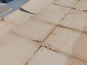 The map was stored folded with its original linen backing. Damp damaged sections were badly stained. Mould had broken down the paper causing it to crumble, and it was incredibly fragile in some sections.
The map was composed of six separate sheets of handmade 'Whatman' paper dated 1839 and had been drawn using a combination of graphite pencil, carbon-based inks, red ink, and watercolours. There were also notes and signatures written using iron gall ink.
The first stage was to assess the condition of each section by carefully separating them out and flattening them under boards and weights. Once relaxed, each sheet was carefully cleaned front and back using soft brushes and specialist conservation cleaning sponges. This proved very time consuming due to the fragile nature of the paper.
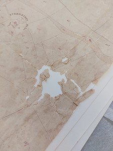
Each sheet was then gently humidified to allow the folds to be eased out, and for loose sections to be positioned and matched up with the appropriate sheet.
The County Archivist agreed that the best approach would be to reline the map to consolidate the six sections into one, which would have been the original format. Another approach would have been to repair each section separately and store them together in a folder or portfolio binding. This would have been a less challenging repair but would have made viewing the entire map more difficult.
Conservation treatment
As the map was to be stored rolled, I chose a flexible but strong lining of Japanese paper, with a thinner, consolidating layer of very thin Japanese Kozo paper in between the original map and the lining to ensure adhesion.
We have a well-equipped conservation studio at Surrey History Centre, which includes a large back lit glass wall, designed for conserving large format paper items. I applied a lining to the light wall using a woven polyester carrier to allow easy removal after conservation.
The cleaned map sections were carefully washed individually on a supportive screen in our large sinks. The sheets were initially wetted with an ethanol solution to strengthen the paper and allow water penetration. They were then float washed to avoid moving the water sensitive inks until the water ran clear. The process can be seen in this Surrey Heritage TikTok video.
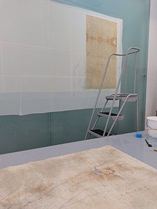 Once washed, the sections were carefully positioned one at a time onto polythene and pasted onto the lining on the light wall using wheat starch paste. They had to be placed in a specific order so that any overlapping sections were positioned correctly. Any loose fragments were carefully positioned once the main body of the map was in place.
Once pasted in position on the lining, the map was allowed to dry thoroughly for several weeks, and overlapping areas were smoothed down using a bone folder.
The next stage was to infill the missing areas with an archival quality handmade paper of matching tone, texture, and thickness. This Surrey Heritage TikTok video shows how an infill is needled out using the back lit wall.
Infills can take a long time on such a large document, as there are many small holes and cracks to fill to ensure the conserved map is fully consolidated.
Preservation and storage
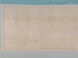 Once all infills are complete, the map will be carefully lifted from the light wall using the carrier and left to relax under boards and weights before rolling onto a support tube. It will be wrapped in archival cloth and stored on our archive storage map shelving. The map will be digitised for access to prevent potential damage from rolling and unrolling.
If you would like to hear more about the conservation of this map, you can purchase a copy of our 'Behind the Scenes in Conservation' talk.
Images
Select image to view a larger version.
- Chessington tithe map in bundle before repair
- Unfolding the damaged map
- Section of the damaged tithe map
- Tithe map being lined
- Finished map on the light wall

