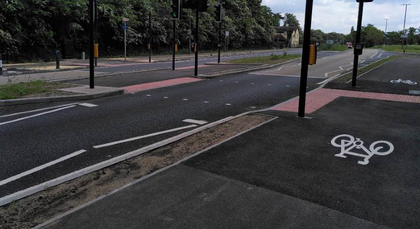
To celebrate Bike Week from 9 to 15 June, we wanted to share some of our favourite cycle routes in Surrey which could help you get from A to B. Many people are already using the routes and enjoy pedalling their journey, but if you live nearby to some of these routes, why not give them a go if you can?
- Ewell to Epsom
- Staines-upon-Thames to Heathrow
- Weybridge to Brooklands
- Westvale Park to Horley
- Leatherhead to Dorking
Visit our cycle network web page for maps on cycle routes across the county and listed cycle routes. You can also visit our plans to improve walking and cycling facilities web page, to find out more.
Ewell to Epsom
Start: Near Spring Tavern, Ewell
Finish: Epsom rail station
Distance: 3.7km (approx. 15 minutes)
Key destinations on or near route: Epsom rail station, Blenheim High School, Epsom Primary School, Longmead Business Park, Longmead Industrial Estate.
This ride provides a quick and mostly traffic-free way of getting between the two towns and can often prove a quicker option than driving along the A24 during rush hour. Part of the route follows the banks of the Hogsmill River and it also connects two large schools in the area, offering a great opportunity for active journeys to school. Visit the Ewell to Epsom online interactive map to view this route.
Staines-upon-Thames to Heathrow
Start: Iron Bridge, Staines
Finish: Southern Perimeter Road, Heathrow
Distance: 5km (approx. 20 minutes)
Key destinations on or near route: Staines town centre, Heathrow (Terminal 5 and Cargo Centre), Ashford Hospital, Town Farm Primary School, North East Surrey Short Stay School.
Many of the cycle facilities between Staines and Heathrow have been improved in recent years offering a high-quality cycle route to the airport via the residential area of north Ashford and Stanwell. Apart from a handful of low-traffic streets, the route is entirely separated from vehicles, including through the Crooked Billet roundabout junction. An alternative secondary route is also available for those looking for a slightly shorter route that avoids north Ashford and instead passes to the west of the Staines Reservoirs. Visit the Staines to Heathrow online interactive map to view this route.
Weybridge to Brooklands
Start: Weybridge town centre (Baker Street)
Finish: Tesco superstore, Brooklands
Distance: 4.5km (approx. 18 mins)
Key destinations on or near route: Weybridge town centre, Weybridge rail stations, Brooklands College, Brooklands Museum, Brooklands business and retail park
Several improvements have been made to this route in recent years to provide an end-to-end route between the town centre and the business parks at Brooklands via quiet roads and traffic-free paths through areas of heathland. It connects to several popular destinations along the way that are just beyond the main town centre, including the rail station and Brooklands College. Visit the Weybridge to Brooklands online interactive map to view this route.
Westvale Park to Horley
Start: Westvale Road, Westvale Park
Finish: Horley rail station
Distance: 5km (approx. 20 mins)
Key destinations on or near route: Horley rail station, Hookwood retail park, Spire Gatwick Park Hospital, Westvale Park Primary Academy
New and upgraded pedestrian and cycle facilities have been installed along much of the route from the Westvale Park housing development to Horley rail station via Hookwood. The improvements now give the option to cycle along the A217 on a facility that is separate from vehicles. Once the Westvale Park development is fully completed it will also enable a new route for people to cycle between the A217 and A23 near Salfords. Visit the Westvale Park to Horley online interactive map to view this route.
Leatherhead to Dorking (via Mickleham and Westhumble)
Start: Leatherhead Leisure Centre
Finish: Dorking town centre (High Street)
Distance: 7.5km (approx. 25 minutes)
Key destinations on or near route: Boxhill & Westhumble rail station, Dorking (Main) rail station, Dorking Deepdene station, Box Hill, The Ashcombe School.
For most of its length, the journey between Leatherhead and Dorking runs parallel to the River Mole along a shared facility set back from the A24, providing a pleasant and direct route that offers views of both Box Hill and Denbies Vineyard. The section of the route from Box Hill to Dorking is signposted as part of National Cycle Network Route 22. Visit the Leatherhead to Dorking online interactive map to view this route.